UN
37 Talman Grove
£ 249,999
Description
We don't have a Description for this property.
- Bedrooms
- 2
- Bathrooms
- 0
- Furnished
- true


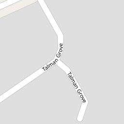


Leaflet © OpenStreetMap contributors
The heatmap indicates the level of crime in the area. The color of the heatmap indicates the crime severity and recency.
Metrics Year-on-Year
- Average area value
- 623,952.00 £Decreased by 17.13 %
- Average area rental value
- 2,389.00 £/moIncreased by 8.44 %
- Est rental Yield
- 4.59 %Increased by 30.77 %
- Crime Rate
- 4.00 %Unchanged by 0.00 %
from 752,973.00 £
from 2,203.00 £/mo
from 3.51 %
from 4.00 %
Nearby Schools
| Name | Type | Ofsted | Distance |
|---|---|---|---|
| Avanti House School | Free Schools | Good | 0.48 KM |
| Whitchurch Primary School & Nursery | Community School | Good | 0.56 KM |
| Stanmore College | Further Education | Good | 0.69 KM |
| Stanburn Primary School | Community School | Good | 0.84 KM |
| Aylward Primary School | Academy Sponsor Led | Good | 0.93 KM |
Images
Nearby Streets
| Name | Average Price | Average Sqft | Distance |
|---|---|---|---|
| Peters Close | £ 654,875 | 0 | 0.00 KM |
| Marsh Lane | £ 0 | 0 | 0.00 KM |
| Laburnum Court | £ 450,000 | 0 | 0.00 KM |
| Ray Gardens | £ 350,000 | 0 | 0.00 KM |
| Chestnut Avenue | £ 0 | 0 | 0.00 KM |
Nearby Transport
| Name | NLC | TLC | Distance |
|---|---|---|---|
| Kenton | 1399 | KNT | 3.70 KM |
| Harrow And Wealdstone | 1397 | HRW | 4.04 KM |
| South Kenton | 1453 | SOK | 4.74 KM |
| Harrow-On-The-Hill | 598 | HOH | 5.20 KM |
| Elstree And Borehamwood | 1542 | ELS | 5.25 KM |
Nearby Listings
| Address | Price | Type | Score | Distance |
|---|---|---|---|---|
| Talman Grove, Stanmore, HA7 | £ 320,000 | BUY | 6 / 10 | 0.06 KM |
| Pembroke Lodge, Du Cros Drive, Stanmore | £ 265,000 | BUY | Unknown | 0.06 KM |
| Pembroke Lodge, Du Cros Drive, Stanmore | £ 240,000 | BUY | 5 / 10 | 0.06 KM |
| Pembroke Lodge, Du Cros Drive, Stanmore | £ 275,000 | BUY | 5 / 10 | 0.06 KM |
| Talman Grove, Stanmore, HA7 | £ 600,000 | BUY | 7 / 10 | 0.06 KM |
Nearby Properties
| Address | Price | Distance |
|---|---|---|
| 50 Talman Grove | £ 171,500 | 0.00 KM |
| 55 Talman Grove | £ 350,000 | 0.00 KM |
| 43 Talman Grove | £ 250,000 | 0.00 KM |
| 38 Talman Grove | £ 205,000 | 0.00 KM |
| 39 Talman Grove | £ 120,000 | 0.00 KM |